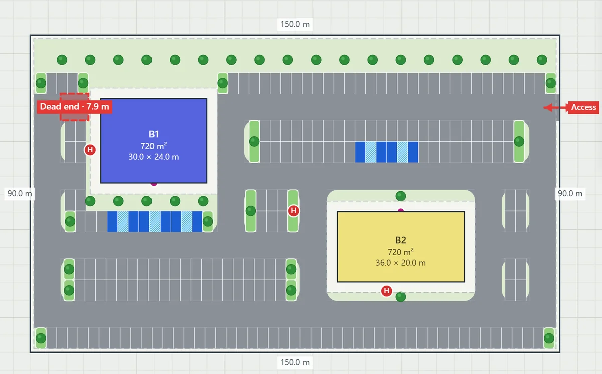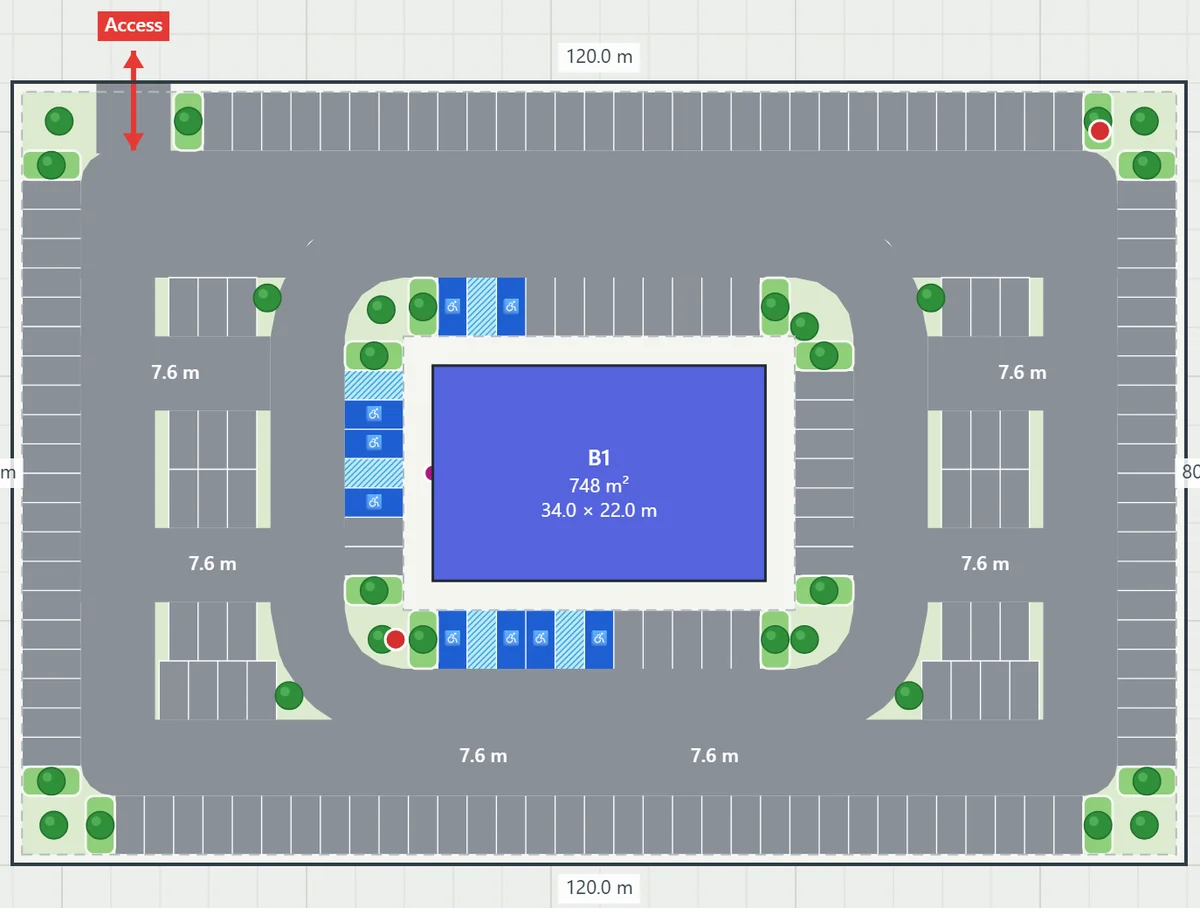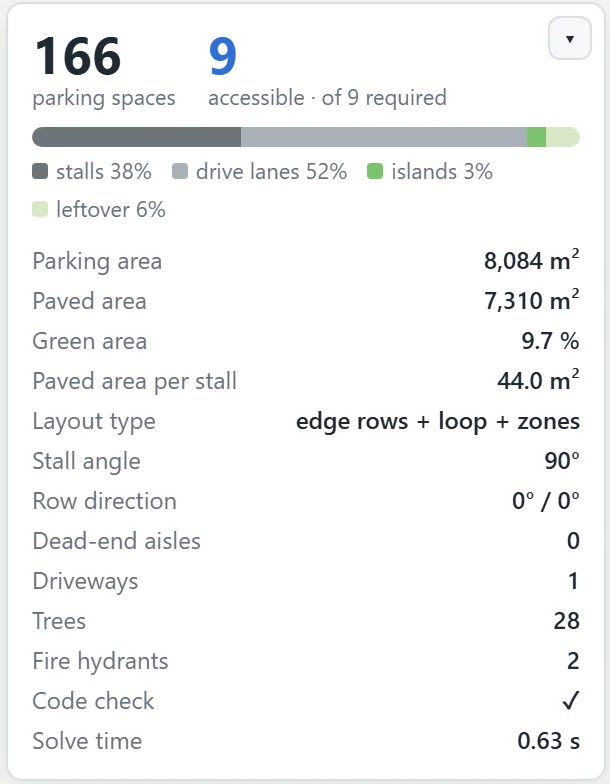
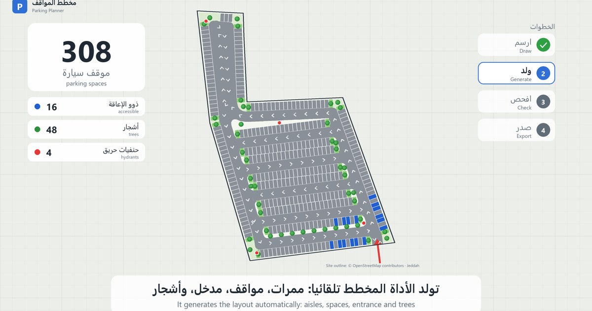
Surface Parking Planner turns a site outline into a complete outdoor parking layout. Import a CAD or PDF site plan (or draw the site and its buildings), and the engine generates stalls, drive aisles, entry and exit, planted islands, trees, accessible stalls and fire hydrants — with live statistics, a code check and a traffic-flow check. It is pure computational geometry and rules: no machine learning, fully deterministic.
How It Works
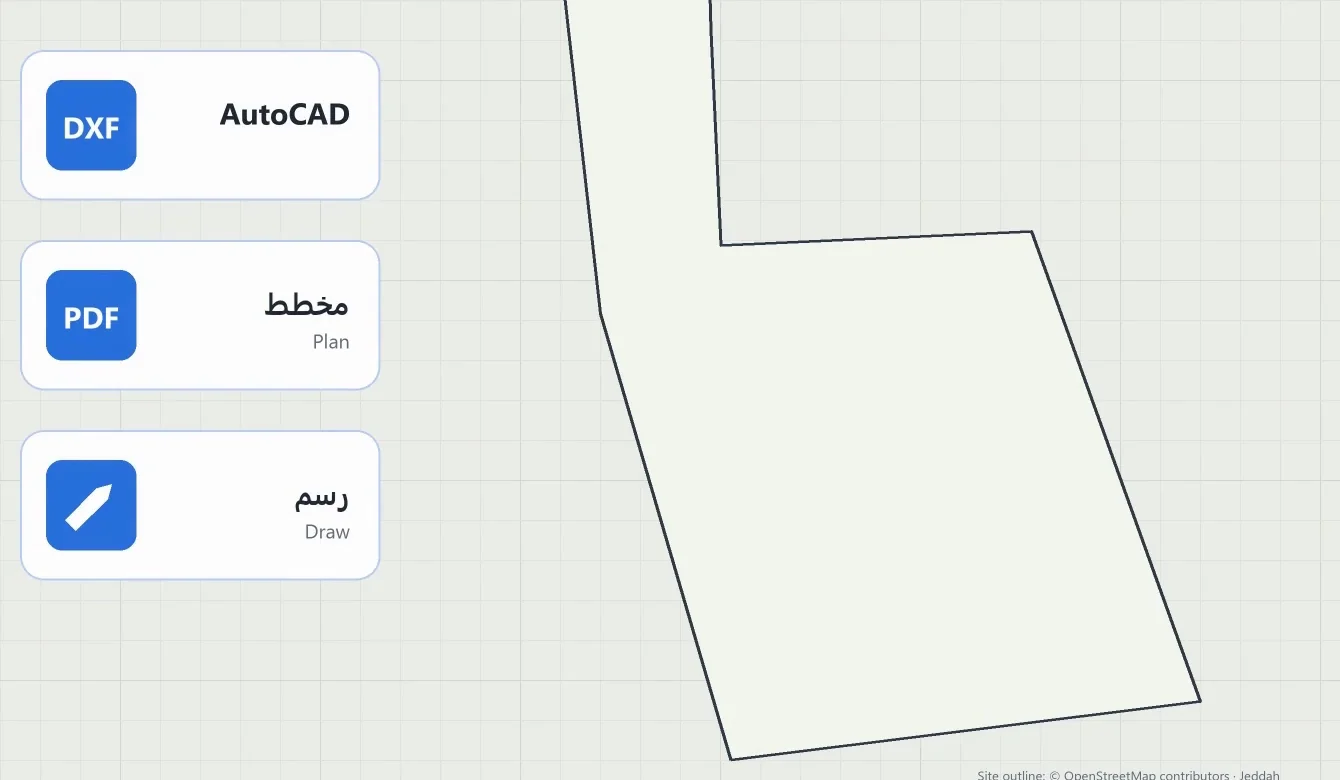
- Import a DXF or PDF site plan: the largest closed outline becomes the site, closed outlines inside it become buildings
- Or draw the site and buildings directly, then drag corners and entry / exit arrows to adjust
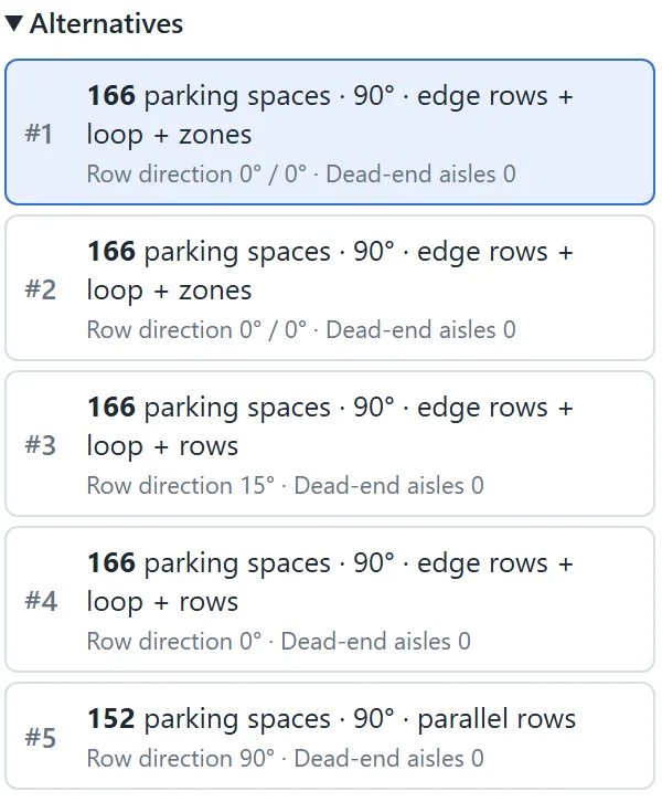
- More than 300 layouts are evaluated per site, and the 5 best alternatives are ranked side by side
- Export the result to CAD (.dxf) or PNG
The Generator
- Three layout families compete: perimeter + ring, zones split by spine aisles, and parallel bays
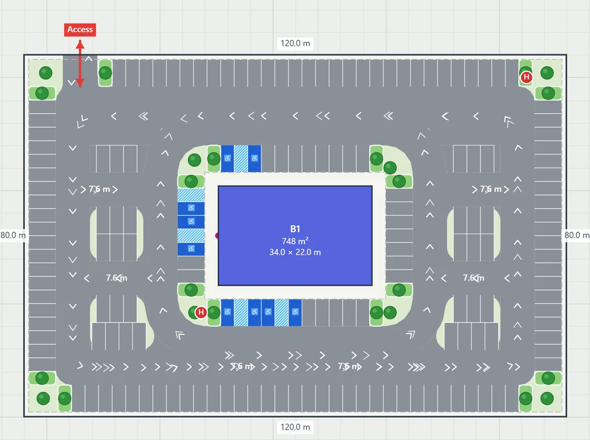
- Stall angles of 90, 60, 45 and 0 degrees, with one-way angled aisles and arrows
- An orientation sweep and exact geometry guarantee every stall sits fully inside the parkable area
- Accessible stalls are grouped at the building side that faces the most parking
- Green-area and tree targets: stalls are converted evenly into planted islands until the target is met
Fire & Emergency Checks
- Fire lanes of at least 6 m and building walls within 45 m of a fire lane
- Dead ends of 45 m or less, with unreached walls drawn in red
- Hydrants placed next to fire lanes with 150 m maximum spacing
Traffic Flow
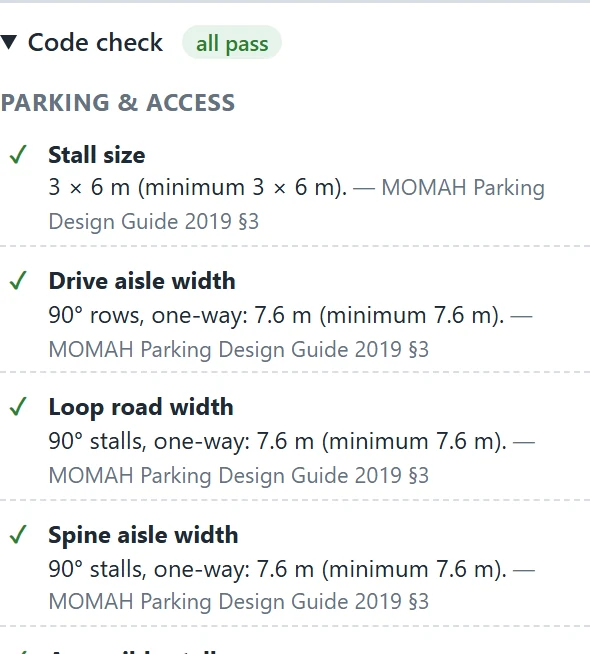
- Ring and spine roads are one-way at 7.6 m (MOMAH table 2: two-way would need 15.2 m), and each lane is given a direction so every lane can still reach every other
- Animated arrows show the direction of travel in every lane
- A flow check turns the lanes into a directed graph and confirms a car can reach every aisle from the entrance and drive back out, obeying the one-way arrows
- One click highlights dead ends and unreachable stretches on the plan, with their length in metres
Rules
- Saudi rules by default: MOMAH Parking Design Guide, Saudi Fire Code SBC 801 and SBC 201 accessibility
- US rules (IFC / IBC / ADA) available as an option
- Tested on real Saudi parking lots from OpenStreetMap and a stress test of about 50 sites
A screening tool for feasibility and early options — the final design is still checked by an engineer with the municipality and Civil Defense.
مُخطِّط المواقف السطحية يحوّل حدود الموقع إلى مخطط مواقف سيارات خارجية كامل. استورد مخطط الموقع بصيغة CAD أو PDF (أو ارسم الموقع ومبانيه)، ويولّد المحرّك المواقف والممرات والمدخل والمخرج والجزر المزروعة والأشجار ومواقف ذوي الإعاقة وحنفيات الحريق — مع إحصاءات فورية وفحص للاشتراطات وحركة السير. يعتمد على الهندسة الحسابية والقواعد فقط، بدون تعلّم آلي، ونتائجه ثابتة وقابلة للتكرار.
طريقة العمل
- استيراد مخطط DXF أو PDF: أكبر شكل مغلق يصبح حدود الموقع، والأشكال المغلقة داخله تصبح مباني
- أو رسم الموقع والمباني مباشرة، ثم سحب الزوايا وأسهم المدخل والمخرج للتعديل
- تُقيَّم أكثر من 300 تخطيط لكل موقع، وتُرتّب أفضل 5 بدائل جنباً إلى جنب
- تصدير النتيجة إلى CAD بصيغة .dxf أو صورة PNG
المحرّك
- ثلاث عائلات تخطيط تتنافس: المحيط مع الحلقة، والمناطق المقسّمة بممرات رئيسية، والصفوف المتوازية
- زوايا مواقف 90 و60 و45 و0 درجة، مع ممرات مائلة باتجاه واحد وأسهم
- مسح للاتجاهات وهندسة دقيقة تضمن أن كل موقف داخل المساحة القابلة للوقوف بالكامل
- مواقف ذوي الإعاقة تُجمَّع عند جانب المبنى المواجه لأكبر عدد من المواقف
- أهداف للمساحة الخضراء والأشجار: تتحول المواقف بالتساوي إلى جزر مزروعة حتى يتحقق الهدف
فحص الحريق والطوارئ
- مسارات إطفاء لا يقل عرضها عن 6 م، وجدران المباني ضمن 45 م من مسار الإطفاء
- نهايات مغلقة لا تتجاوز 45 م، والجدران غير المخدومة تظهر باللون الأحمر
- حنفيات حريق بجوار مسارات الإطفاء بتباعد لا يتجاوز 150 م
حركة السير
- الطريق الدائري والممرات الرئيسية باتجاه واحد بعرض 7.6 م (الجدول 2 في دليل وزارة البلديات: الاتجاهان يحتاجان 15.2 م)، ويُحدَّد اتجاه كل حارة بحيث تبقى كل حارة قابلة للوصول من كل حارة أخرى
- أسهم متحركة تُظهر اتجاه السير في كل حارة
- فحص للحركة يحوّل الحارات إلى شبكة باتجاهات، ويتأكد أن السيارة تصل إلى كل ممر من المدخل وتخرج منه دون مخالفة اتجاه السير
- بضغطة واحدة تُبرز الأداة الممرات المسدودة والأجزاء التي لا يمكن الوصول إليها على المخطط، مع طولها بالمتر
الاشتراطات
- الاشتراطات السعودية افتراضياً: دليل تصميم مواقف السيارات (وزارة البلديات والإسكان)، وكود الحماية من الحريق SBC 801، وكود البناء SBC 201 لإمكانية الوصول
- الاشتراطات الأمريكية (IFC / IBC / ADA) اختيارياً
- مُختبر على مواقف سعودية حقيقية من OpenStreetMap واختبار تحمّل على نحو 50 موقعاً
أداة دراسة أولية لتقدير الجدوى والبدائل المبكرة — ويبقى التصميم النهائي خاضعاً لمراجعة مهندس مع البلدية والدفاع المدني.